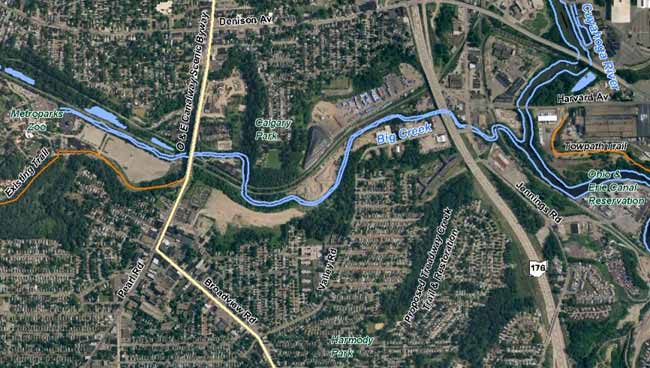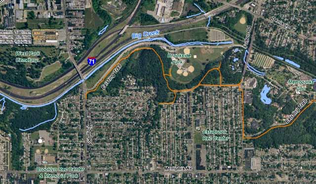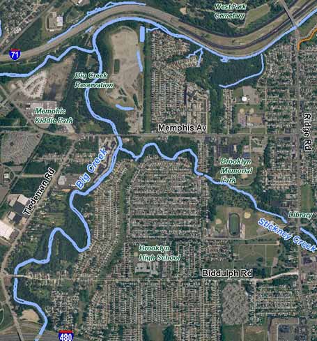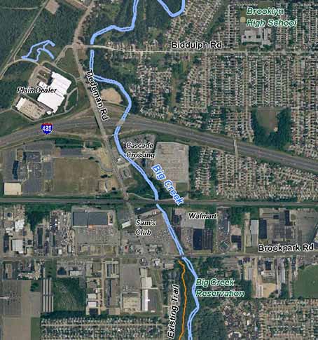

About Big Creek WatershedBig Creek, the 3rd largest tributary of the Cuyahoga River, enters the Cuyahoga River 7.4 miles above the mouth of the Cuyahoga in Cleveland at Lake Erie. Big Creek's watershed contains over 130 miles of streams and culverts. Together they drain nearly 38 square miles from 8 municipalities — Cleveland, Brooklyn, Linndale, Parma, Parma Heights, Brook Park, Middleburg Heights, and North Royalton. Over 90% of the watershed’s area has been developed and nearly 40% of the land surface has been made impervious, making Big Creek the most heavily urbanized watershed of any major tributary in the Cuyahoga River Watershed. This degree of urbanization provides tremendous challenge…and opportunity! Cleveland Water Pollution Control Big Creek Watershed brochure View larger pdf map from the FOBC brochure (print version mailed upon request)
Denison Avenue and Triskett Road bound Big Creek roughly on the north, I-71 on the west and State Road on the east. The southern boundary slopes in a rough diagonal line running from near Snow Road near I-71 to Pleasant Valley Road between West 130th and York to Wallings Road near State Road.
FOBC Conceptual Plans for Proposed Trail Alignments Big Creek greenway/parkway
- |
Friends Of
Big Creek Water Quality 2007 Test Data [pdf].
J. Gazda and, A. Penko. SITES FOR MORE INFORMATION Lower Big Creek Valley Greenway Redevelopment & Restoration Plan: prepared by Floyd Browne Group in association with schmidtcopelandparkerstevens, June 2008. Project partners: Cleveland Metroparks, City of Cleveland, Ohio Canal Corridor, Old Brooklyn Community Development Corporation. The plan presents "a new vision for the Valley Greenway. The creation of this vision incorporates detailed future land use, public access, infrastructure, ecological restoration and environmental regeneration, open space and trail linkages and economic development concepts." Section
One: 1. Introduction; 2. Valley Resources; 3. Public Involvement;
4. Trail Route Alternatives; 5. Trail & Greenway Concept (Upland
& Valley Trail Descriptions (19MB) NOACA: Lower Big Creek Study:
Land Use, Environmental and Transportation Conditions in the Lower Big
Creek Area of Cleveland, Ohio: An Assessment and Strategy for Future
Action Phase 1 Report Final 2002 GIS Wetlands Inventory and Restoration Assessment Cuyahoga River Watershed Cuyahoga County, Ohio October, 2003. Prepared for Cuyahoga River RAP. Prepared by Davey Resource Group State of Big Creek Report, Cuyahoga River RAP + NOACA April, 2001 (278K pdf- 26 pages) |


